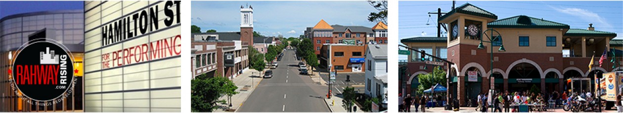
Almost the entire block that includes the former RSI bank building, the former API Foils site on New Brunswick Avenue, and a string of properties along Pierce Street that already have been acquired by a developer will be studied by the Planning Board to determine if they qualify for redevelopment under state law.
If you find this post valuable, consider making a contribution via PayPal or Buy Me a Coffee – or support local news you don’t get anywhere else all year round by becoming a monthly Patron.
.City Council is poised to approve five resolutions during its regular meeting tonight at 7 p.m., to examine 14 properties in all, some of which pursue align with the city’s downtown strategic plan adopted last year. Among the resolutions is one (AR-146-23) to award a $60,000 contract to Heyer Gruel & Associates to conduct redevelopment studies for the Pierce Street properties ($35,000) and the RSI bank block ($25,000) to determine whether they qualify under the state’s redevelopment law (N.J.S.A. 40A:12A-1).
It’s the same process that City Council and Planning Board undertook in recent years with properties along Esterbook Avenue and the former St. Mark’s Church property and adjacent lots.
The resolutions for Pierce Street and the former RSI Bank block authorize City Council to use all powers provided by the state Redevelopment law, including the power of eminent domain (“Condemnation Redevelopment Area”). The resolutions for the properties on New Brunswick and East Inman avenues exclude the power of eminent domain (“Non-Condemnation Redevelopment Area”).
See the map below for all three areas, including details on all 14 properties, and read below the map for more on each.
Former RSI Bank block
.AR-143-23 directs the Planning Board to study four properties that comprise most of the block that includes the former RSI bank on Irving Street:
- 1500 Irving St./Block 154, Lot 2.01
- Broad Street/Block 154, Lot 6.01
- 1405 Campbell St./Block 154, Lot 7.01
- 1447 Campbell St./Block 154, Lot 9

RSI was acquired by Columbia Bank about two years ago. In addition to the Columbia Bank building, the study would investigate all but one property on the block, World of Life Apostolic Church, including a surface parking lot (Lot F) owned by the city, a two-story office building, and a one-story building that’s headquarters of the New Jersey Firefighters Mutual Benevolent Association (FMBA), the state firefighters union.
 The downtown strategic plan identified the block as one of 14 “opportunity sites” downtown and offered two variations of a concept for a 10- to 12-story building that would include 4 to 5 stories of parking and 4 or 5 stories of retail and office space.
Combined, the four properties are assessed for $3,769,400, generating property taxes of about $241,646.
Pierce & Fulton street properties
.AR-142-23 directs the Planning Board to study eight properties along Pierce and Fulton streets and East Milton Avenue across from the train station:
- 65-73 E. Milton Ave./Block 312, Lots 1.01
- 97 E. Milton Ave./Block 312, Lot 3
- 1348 Pierce St./Block 312, Lot 4.01
- 1340 Pierce St./Block 312, Lot 4.02
- 1334 Pierce St./Block 312, Lot 4.03
- 1349-53 Fulton St./Block 312, Lot 4.04
- 1308 Pierce St./Block 312, Lot 5
- 1305 Fulton St./Block 312, Lot 23
.AST Development, the Lavallette-based firm behind Reva Rahway on Main Street and Metro Rahway on Campbell Street, acquired four of the properties (noted in italics above) several years ago.
The study would extend along Pierce Street as well as Fulton Street, including the former Mangos restaurant site (1349-53 Fulton St.) and the next property. The site had been vacant for years has been used for parking since being acquired by the Parking Authority in 2018. The property also was identified among 14 “opportunity sites” in the strategic plan. Other properties, however, are active, such as 65-73 E. Milton Ave., a two-story mixed use building with ground-floor retail that includes Michelino’s Pizza, Barber Gods, and Copacabana Coffee, among others.
Combined, the eight properties were most recently assessed for $2,477,300, generating property taxes of approximately $139,504.
Former API Foils site
.AR-144-23 and AR-145-23 directs the Planning Board study the former API Foils site at 329 New Brunswick Ave. and a nearby empty lot at 101 E. Inman Ave., 211 E. Inman Ave., respectively. The two lots are separated by elevated railroad tracks that run NJ Transit’s North Jersey Coast Line and a 3-acre strip owned by Conrail.
UPDATED, 8/1/23: City Council in July adopted another resolution (AR-158-23) correcting AR-145-23. Block 277, Lot 21 at 211 E. Inman Ave. will be investigated for redevelopment – not Block 276, Lot 1 or Block 277, Lot 1.
 The former API/Dri-Print Foils building on New Brunswick Avenue was acquired about a year ago by a Denver-based investment firm for $62 million. The 26.4-acre property abuts several city-owned parcels along the South Branch of the Rahway River at the Woodbridge border near Little Street and Woolean Place. The property and several adjacent sites were among six areas identified to be studied for redevelopment in 2016 but concerns raised by the public seemed to push off that effort. The property is assessed for $3,146,000, generating property taxes of $224,970.45.
The 211 E. Inman Ave. property (Block 277, Lot 21) was sold in June 2018 for $1.15 million by 211 East Inman Avenue, LLC. Assessed for $103,500, the empty lot generates property taxes of $7,268. It’s an empty lot located next to the Woodbridge border near Mill Street.
The East Inman Avenue property changed hands in January for $2 million, according to property records, with an entity called Inman Avenue 2022, LLC acquiring the nearly half-acre lot from Breza Bus Service, with “parcels conveyed as a package deal.” The nearly half-acre lot is assessed for $227,100 , yielding about $15,946.96 in property taxes.
Combined, the two properties are assessed for $3,373,100, for property taxes of about $240,917.41.
If you found this post valuable, consider making a contribution via PayPal or Buy Me a Coffee – or support local news you don’t get anywhere else all year round by becoming a monthly Patron.

4 thoughts on “RSI Bank block, other areas to be studied for redevelopment”